The Ancient Foundation: Geological Formation of the Talamanca Range
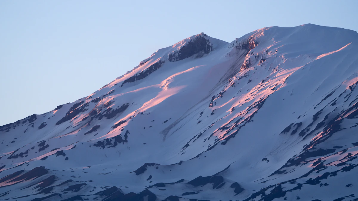
The majestic Talamanca Mountain Range, home to Chirripó National Park, is a testament to millions of years of dynamic geological forces. Understanding its formation is key to appreciating the rugged beauty and unique ecosystems found here today.
As an Amazon Associate, we earn from qualifying purchases.
Tectonic Activity and Volcanic Origins
The story of the Talamanca Range begins deep beneath the earth’s surface, where the Cocos Plate subducts beneath the Caribbean Plate. This intense tectonic activity, which started roughly 20-25 million years ago, led to significant uplift and widespread volcanic activity. Over eons, molten rock pushed upwards, creating a complex series of volcanic peaks and sedimentary deposits that would eventually form the backbone of what we now know as the Isthmus of Panama and Costa Rica.
Unlike some of Costa Rica’s more active volcanic chains, the Talamanca Range represents an older, more stable volcanic arc. The peaks of Chirripó, like Cerro Chirripó itself, are composed primarily of granodiorite, a coarse-grained igneous rock that cooled slowly beneath the earth’s surface before being exposed by massive uplift and erosion. This sturdy composition contributes to the range’s impressive height and resilience.
The Shaping Hand of Glaciation
While Costa Rica is often associated with tropical warmth, the Talamanca Range experienced a colder past. During the Pleistocene epoch (roughly 2.6 million to 11,700 years ago), successive ice ages saw glaciers descend to altitudes as low as 3,500 meters (11,500 feet) in the highest parts of the range, including what is now Chirripó National Park. These powerful rivers of ice carved out the distinctive U-shaped valleys, cirques, and moraines that are still visible today.
Many of Chirripó’s high-altitude lakes, such as those found in the Valle de los Lagos, are pristine examples of glacial tarns—lakes formed in these glacially carved depressions. This glacial history is a crucial aspect of the geology of the Talamanca Mountains, differentiating it from other Central American mountain ranges and contributing to its unique alpine-like landscapes.
A Human Story: Indigenous Roots and Early Exploration
Long before it became a national park, the Talamanca Range was a sacred landscape, rich with cultural significance and life.
The Cabécar and Bribri Peoples
For thousands of years, the remote forests and peaks of the Talamanca region have been home to indigenous communities, most notably the Cabécar and Bribri peoples. These groups, part of the Chibchan linguistic family, have maintained a profound spiritual and practical connection to the land, viewing it not just as a resource but as a living entity central to their worldview and traditions. Their oral histories and cultural practices are deeply intertwined with the rivers, mountains, and forests of Chirripó, reflecting generations of sustainable living and intricate knowledge of the local ecosystems. The indigenous history of Chirripó is a story of resilience and deep spiritual connection.
Early Encounters and Scientific Expeditions
While indigenous peoples thrived for millennia, external exploration of the higher reaches of the Talamanca Range by Europeans was relatively late due to the extreme ruggedness and dense forests. Spanish chroniclers documented the presence of indigenous groups in the foothills, but the highest peaks remained largely uncharted by outsiders for centuries.
In the late 19th and early 20th centuries, a growing interest in Costa Rica’s natural resources and biodiversity led to the first scientific expeditions into the Talamanca mountains. These early explorers and naturalists faced immense challenges, battling harsh weather, dense vegetation, and remote terrain. Their efforts helped to map the area and document its unique flora and fauna, laying the groundwork for future conservation efforts. However, the spiritual and historical significance held by the local communities often predated and surpassed these scientific observations.
From Protection to Park: The Birth of Chirripó National Park
The journey from an unexplored wilderness to a protected national park is a significant chapter in Chirripó’s modern history.
The Vision for Conservation
As the mid-20th century progressed, increasing awareness of environmental degradation and the unique biodiversity of Costa Rica spurred a national movement towards conservation. The Talamanca Range, with its high peaks, pristine ecosystems, and crucial water sources, quickly became recognized as an area of paramount importance. Ecologists, government officials, and local communities began to advocate for its formal protection, understanding that its ecological integrity was vital for the entire country.
Establishing the Park
Chirripó National Park was officially established on August 19, 1975, encompassing an expansive area that safeguards some of Costa Rica’s most biodiverse and ecologically sensitive habitats. Its creation was a landmark achievement, reflecting a growing commitment by the Costa Rican government to preserve its natural heritage. The park was named after its highest peak, Cerro Chirripó, which translates from the indigenous Cabécar language to “land of eternal waters” or “place of magic waters,” a fitting tribute to its crucial role as a water source for surrounding communities and a haven for diverse life.
Today, Chirripó National Park is managed by the SINAC (National System of Conservation Areas) and is part of the larger La Amistad International Park, a UNESCO World Heritage Site that spans both Costa Rica and Panama. This designation underscores its global importance for biodiversity conservation and its role as a key natural area. Consider ways to offset your travel carbon footprint when visiting such precious sites.
Understanding Chirripó’s Unique Ecosystems
The combination of ancient geology, elevation, and climate has fostered a spectacular array of ecosystems within Chirripó National Park.
Paramo and Cloud Forests
As you ascend through the park, you encounter dramatic ecological transitions. The lower slopes are cloaked in lush cloud forests, perpetually shrouded in mist, supporting an incredible diversity of plant and animal life. These forests are vital for water regulation and host unique species adapted to their humid conditions. Learn more about the amazing creatures here by visiting our guide to wildlife and birdwatching in Chirripó National Park.
Above approximately 3,000 meters (9,800 feet), the cloud forest gives way to the paramo, a rare high-altitude grassland ecosystem characterized by dwarf bamboo, shrubs, and hardy endemic plants. This windswept, treeless landscape, sculpted by past glaciations, is reminiscent of Andean ecosystems and offers stark, breathtaking beauty.
Biodiversity Hotspot
Chirripó National Park is recognized as a global biodiversity hotspot. Its varied altitudinal zones, from tropical montane forests to subalpine paramo, provide habitats for an astonishing array of species. From elusive pumas and tapirs to thousands of insect species and a rich diversity of amphibians, reptiles, and birds, the park is a living laboratory of evolution and adaptation. The unique flora, including many endemic species, further highlights its ecological significance.
Planning Your Journey to Chirripó
Inspired by the rich history of Chirripó National Park and its fascinating geology? Planning a trip to this incredible destination requires proper preparation, including Costa Rica travel insurance. The challenging terrain and high altitudes demand respect and proper planning. Check out our detailed guides to learn about the trails and their difficulty, and your essential guide to hiking Cerro Chirripó for everything you need to know before you go.
Frequently Asked Questions About Chirripó National Park’s History and Geology
When was Chirripó National Park established?
Chirripó National Park was officially established on August 19, 1975, to protect its unique high-altitude ecosystems and diverse biodiversity.
What created the Talamanca Mountain Range?
The Talamanca Mountain Range was primarily formed by the subduction of the Cocos Plate beneath the Caribbean Plate, leading to massive uplift and volcanic activity over millions of years.
Did glaciers exist in Costa Rica?Yes, during the Pleistocene epoch, glaciers covered the highest parts of the Talamanca Mountain Range, including what is now Chirripó National Park, carving out its distinctive valleys and lakes.
Who are the indigenous peoples of the Chirripó region?The primary indigenous groups with historical and ongoing ties to the Chirripó region are the Cabécar and Bribri peoples, who have a deep cultural and spiritual connection to the Talamanca Mountains.
